Home
cartesian_planner provides the raster scanning node used by the door-disassembly workflow.
- Architecture
- Running the Node
- Interfaces and Data
- Raster Algorithm
- Integration with Finite-State-Machine
Main source files:
Raster path visualization:
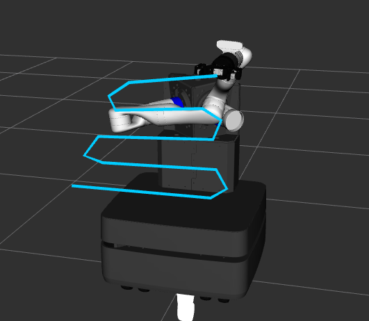
At a high level, raster_scanner:
- receives four door corner poses
- generates a zig-zag raster path between them
- executes each waypoint through
right_arm/arm_control - requests perception after each waypoint with
task_name = detect_screws - collects screw poses returned by perception
- returns those poses in the
PlanScanPathservice response
If a waypoint returns no screw detections, that is treated as a normal result and the raster continues.